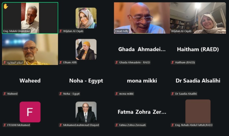
The Kuwait Environment Protection Society, in cooperation with the Kuwaiti Society for Earth Sciences, organized a workshop on “Artificial Intelligence Applications in Earth and Environmental Sciences” with the participation of 35 male and female teachers included in the second section of the 14th season of the “Green Schools” educational and awareness program organized annually by the Society for the Environment.
Janan Behzad, Secretary General of the Environment Society, confirmed that the “Artificial Intelligence Applications in Earth and Environmental Sciences” workshop comes as a complement to the role of the “Green Schools” program in awareness and education, indicating that organizing the workshop in its electronic version via the Zoom application was to reach the largest number of participating teachers at one time, and this was enhanced by the participation of 35 male and female teachers.
Behzad stated that “the use of artificial intelligence applications in earth and environmental sciences encompasses a wide range of fields and applications and offers innovative solutions for understanding the earth, its characteristics and nature through the Google Earth program,“ praising ”the cooperation of the Kuwaiti Society for Earth Sciences through the participation of Dr. Muhammad Naqi, Vice President of the Society, to present the joint workshop, including his rich scientific lecture on “the use of artificial intelligence applications in earth sciences“ via the Google Earth program.”.
For his part, Dr. Mohammed Naqi presented his scientific lecture and applied models on the uses of artificial intelligence in the fields of earth and environmental sciences, explaining that the “Google Earth” program offers many uses in the field of geology due to its ability to display aerial images, terrain and geological data in an integrated manner. He explained that he presented rock analysis and provided accurate estimates of rock properties and mineral and geological predictions, explored different geographical areas on the Earth’s surface, and identified terrain, mountain ranges and volcanoes in a study of the Madinah region and its lava fields using high-resolution aerial images and three-dimensional information.
Dr. Mohammed Naqi noted the interaction of the teachers participating in the workshop with the program's applications, highlighting through their interventions many scientific aspects in this regard. He added that he provided examples of identifying rock layers and natural formations such as mountains, valleys, and plains, identifying areas of interest for geological research, and planning exploration operations and geological studies in those areas.