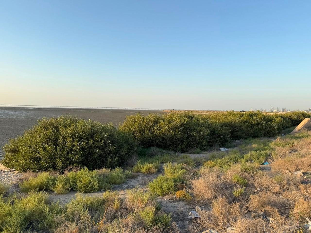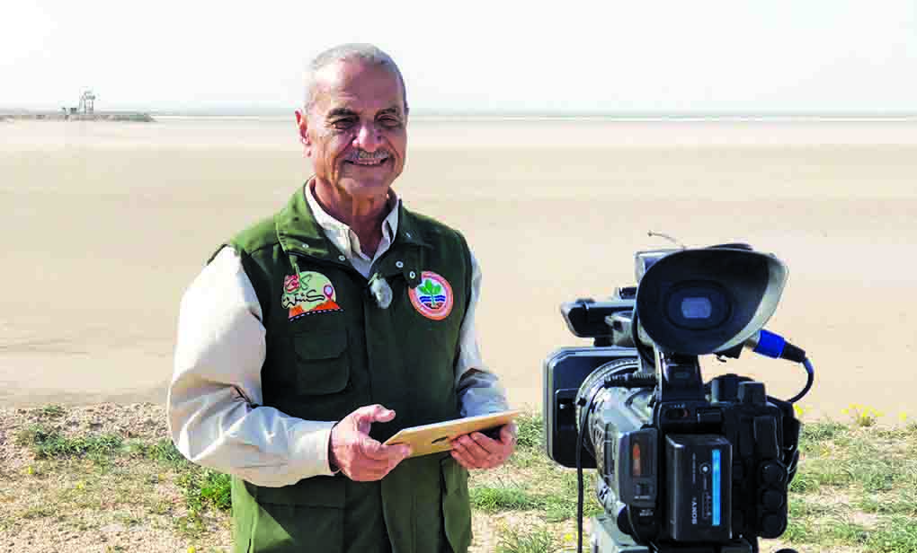
During February and March 2019, several field trips were organized to the demilitarized zone between the State of Kuwait and the Republic of Iraq. The objectives of these trips were as follows: • To monitor and document the plant and animal wildlife. • To describe the most important geographical features of the area, including the salt flats (Al-Bahith Center), the wadis (Al-Salmi, Al-Shaqaya, and Al-Abraq), the depressions (Al-Awazem depressions and Bahrat Hawshan), the sand dunes (Al-Huwaymiliyah and Al-Saqihiyah), and the geological formations, including the Al-Dibdibah and Faris formations. • To conduct television, camera, and drone filming. A multidisciplinary team from the Kuwait Environment Protection Society participated in the surveying, filming, preparation, and presentation of the scientific material.
Features of the demilitarized zone between the State of Kuwait and the Republic of Iraq
The demilitarized zone between the State of Kuwait and the Republic of Iraq constitutes an essential part of Kuwait's natural capital, characterized by its physical and biological diversity. Extending as a border strip between the two countries, the zone stretches for approximately 200 km with an average width of 5 km, covering a total area of 1008 km². It was effectively protected in April 1991 (UN Security Council Resolution 689/1991) and in 2003 became a restricted area.
The demilitarized zone (Security Council Resolution No. 1490) divides the area into four sectors, each sector containing a number of border posts. These sectors are: (from southwest to northeast) Al-Abraq (Al-Abraq posts – Al-Mahzoul – Al-Taawun – Al-Shaqaya – Al-Shaheed Jarman) Al-Khabari (Juraishan posts – Khabari Al-Awazem – Al-Samoud – Al-Saqihiya) Al-Ratqa (Umm Sudairah posts – Al-Sakhibri – Al-Tahrir – Al-Ratqa – Bahra Hawshan) Al-Abdali (Umm Qasr posts – Umm Naqa – Al-Azmiya – Al-Mazari’ – Al-Abdali)
Natural ecosystems
Valleys and depressions (Wadi Al-Batin, Khubari Al-Awazem, and Bahrat Hawshan); rocky escarpments, terraces, and hills; crescent-shaped sand dunes (Umm Naqa and Al-Huwaymiliyah); all types of vegetation (around saltbush, tamarisk, jujube, and tamarisk); plains and gravel undulations (Al-Dabdaba Formation); wetlands (sabkhas). Research on land-use ecosystems (geopolitical aspects).
The border trench (the first task according to the classification of the General Directorate of Borders) The electric fence (the second task according to the classification of the General Directorate of Borders) The outer trench of the demilitarized zone (the third task according to the classification of the General Directorate of Borders) The most widespread plant in the demilitarized zone is the saltbush (Haloxylon salicornicum), which occupies at least 85% of the area. The saltbush thrives in Wadi Al-Batin (Al-Salmi, Al-Shaqaya, Al-Taawun Center and Al-Abraq) and Khubari Al-Awazem and the valleys extending between Al-Ratqa and Al-Abdali, the most important of which are Umm Sudairah and Al-Sakhibiri, and it also thrives in the wild part of Al-Bahith Center. Significant variations have been observed in the size, height, and density of the plants, as well as in the number of wild animals living in their shade. This can be explained by the wide differences in local conditions. For example, the *Rhamnus* plant growing in clay soil containing between 5 and 8 % of organic matter is more robust and more tolerant of harsh conditions. Furthermore, *Rhamnus* plants that trap larger quantities of flood sediments thrive, due to the organic matter and soil-enriching properties of these sediments. In the demilitarized zone, *Rhamnus* plants trap two types of sediment: first, flood sediments (after drying), which consist of a mixture of fine sand, clay, and silt, with a content of approximately 45 % and organic matter ranging from 5 to 8 %; and second, wind-borne sediments, which are sandy and poor in organic matter. This mixture of sediments helps the plant to grow at higher rates and withstand harsh environmental conditions.
Details of the tours
The Al-Bahith salt flat is classified into sections devoid of vegetation (sterile salt flat) and sections covered with vegetation (productive salt flat).
The elevation of the Al-Bahith salt flat increases westward. Near the coastline, it is 2 meters above sea level, while at its western edge, it reaches 13 meters. The Al-Bahith salt flat meets the non-saline sandy plains to the west, where the saltbush (Rhamnus) grows densely, approximately 3 kilometers from the intertidal flats of Khor Al-Sabiyah. Recognizing the importance and numerous benefits of salt flats, the international community established the Ramsar Convention on Wetlands in 1971, predating the three Rio Conventions (Combating Desertification, Biodiversity, and Climate Change) by nearly two decades. Governments, peoples, and civil society organizations around the world celebrate World Wetlands Day on February 2nd each year. Wetlands are among the most productive ecosystems and are home to a vast number of plants and animals. The salt flats in Kuwait are an essential part of the natural capital and constitute approximately 8 % of the country's area. Among the most important plants that thrive in the salt flats is the Nitraria retusa plant. The Nitraria plant has economic (pastoral value) and environmental importance, as its roots extend for more than two meters, which helps to hold together and stabilize the soil. The Nitraria plant also has an essential role in maintaining the ecological balance.
The miserables
Al-Shaja, also known as Al-Shaqaya, is said to have produced abundant, inexhaustible water. Al-Shaqaya is one of the highest areas in Kuwait (280 meters above sea level). The area is characterized by fractured and cavernous sandstone belonging to the Dibdibah and Fars formations. The scattered hills and rocky ridges form a crucial watershed in Wadi Al-Batin. Large quantities of rainwater seep vertically through a dense network of fissures into the fractured rock. The runoff flows from the higher elevations to the upper reaches of Wadi Al-Batin and then into the main channel of the wadi. The Al-Shaqaya area is considered a protected zone with high potential for low-salinity groundwater. It is one of the best areas for rainwater and floodwater harvesting. The following are suggested: First, implement a groundwater exploration program in this area. Second, utilize floodwater through a sustainable rainwater and floodwater harvesting plan.
Grishan
We are in the main course of Wadi Al-Batin, specifically next to the tallest Arta shrub in Kuwait. The valley's soil is thick and sandy, saturated with moisture (due to the 2018/2019 rainy season) and rich in organic matter. The vegetation cover is dense and diverse.
(Arfaj, Ramth, and Arta) annual plants cover every inch of the Wadi Al-Batin riverbed. Jurayshan is one of the areas most affected by sand dunes drifting from Iraq, driven by northwesterly winds. At this location, the shifting sands cross the border line and then the border trench, settling on the first obstacle or barrier in their path: a large Arta shrub. The site is approximately 100 meters from the border trench between Iraq and Kuwait. The site's elevation is 95 meters above sea level. The Arta oasis is located in the Jurayshan border center, a fenced area within the demilitarized zone. The reason for the fence is to prevent sand shifted from the border trench from being dumped onto the Arta shrubs (Calligonum polygonoides). There are approximately 15 Arta shrubs, varying in height from 2 meters to 50 centimeters. As stated in the program «Every Day a Plant» prepared by the Kuwaiti Society for Environmental Protection and broadcast by Kuwait Television in 2016, the leaves and flowers of the Arta plant are rich in proteins, and the plant’s leaves are very bitter, so a paste is made from them that is used to treat poisoning. The roots of the Arta plant are boiled and used as a mouthwash. On the other hand, the Arta shrubs represent the best grazing for camels.
The success story began nearly two decades ago with a single Arta shrub (the tallest, most majestic mother shrub in Kuwait, located in the Jraishan area). Over time, the shrub flourished and bore fruit (flat, red fruits covered with soft hairs). It overcame the encroaching sands by growing rapidly upwards, aided by the large water reservoir within the sand dunes surrounding the plant. Northwesterly winds carried the seeds away from the mother shrub, where they settled on moist, sandy soil rich in organic matter. The seeds germinated, and the Arta plants spread, eventually playing their role in trapping sand and stabilizing the soil. Four generations of Arta shrubs have been recorded, each generation associated with a specific rainy season.
Lesson learned (recommendation)
Expanding the cultivation of Arta in the area extending between the two centers of Al-Sumoud (Al-Huwaymiliyah) and Al-Saqihiyah (approximately 20 km long and 5 km wide) to alleviate the problems of encroaching sand dunes
Al-Salmi (Martyr Jarman Center)
We are now in the southern triangle region of Kuwait, where the borders of Saudi Arabia, Iraq, and Kuwait meet. This is the highest point in the country, reaching 280 meters above sea level. Our location is near the Al-Awjah Lagoon. Al-Awjah is a bend in the main channel of Wadi Al-Batin where floodwaters collect. The bend slows the flow of the floodwaters, causing them to accumulate and form lakes that remain for several weeks.
The area is home to the *Ramth* plant, which grows in sandy soils mixed with clay soils transported by flash floods. From our vantage point, we can see the main course of Wadi al-Batin, which was a flowing river during the rainy periods. After climatic conditions changed and drought prevailed, it became a dry valley that flows only once every few years. Wadi al-Batin has geological, hydrogeological, ecological, and environmental significance, in addition to historical importance. As is well known, the valley is located in the northeast of the Arabian Peninsula, starting from the western parts of the peninsula. The valley cuts through the sands of Ad-Dahna and ends at the Shatt al-Arab. It is approximately 500 km long and is called Wadi Ar-Rummah (or Yadhfuz) in Kuwait. Wadi al-Batin extends from Awjah al-Batin in a northeasterly direction for about 75 km. The valley is bordered on both sides by river terraces and hills of limestone and sandstone, interrupted by tributaries. The width of the valley varies between 5 and 7 km. Wadi Al-Batin receives runoff from eastern (Kuwaiti) and western (Iraqi) tributaries. It is called Wadi Al-Batin, meaning "the hidden one," as parts of it are concealed beneath the Ad-Dahna desert. However, these parts reappear when the floodwaters carry away sand dunes in their path, allowing the water to flow back to its course. It is worth noting that the Wadi Al-Batin Reserve is located just a few meters from our current position in the southern triangle. The reserve, covering an area of 910 km², was established by Cabinet Resolution No. 25 of 2011 and is under the supervision of the Public Authority for Agricultural Affairs and Fish Resources. Protecting this important area will lead to a flourishing of both plant and animal wildlife. It is also expected that the soil will stabilize and become more compact, increasing organic matter and soil moisture, and consequently reducing sand and dust storms by at least 20%.
Al-Huwaymiliyah
We are at the beginning of the natural sand dune corridor that stretches from Al-Huwaymiliyah in the northwest to Al-Wafra in the southeast. The corridor is approximately 168 km long and varies in width from 20 to 40 km, with elevations ranging from 135
From 1 to 145 meters above sea level, the area clearly shows signs of wind weathering, characterized by the formation of granule ripple fields. These ripples indicate prolonged wind weathering processes, where the wind transports fine and medium sand grains, leaving behind coarse sand and gravel that the wind cannot carry. Plant roots are also exposed as a result of wind blasting. The sand dune range begins in the Al-Huwaymiliyah area (the center of resilience) in the far northwest of Kuwait and ends in the Al-Atraf area in the southeast. Crescent dunes (also called barchans) are the most common type of sand dune, with a crescent shape and a sloping face, bordered by horns that indicate the wind direction.
Crescent sand dunes form under the following conditions: • Constant winds blowing from a single direction (northwest) with sufficient speed to carry sand. • A source that continuously supplies the wind with sand. • Flat to slightly undulating surfaces composed of non-erosible fragments such as gravel and boulders. • Surfaces with obstacles such as grasses and rocky outcrops that trap the drifting sand. These dunes are distributed in lines called burr lines. The height of the dunes ranges from 3 to 8 meters, and they are composed of quartz (silica), which makes up at least 90% of the dune's composition. The movement of the dunes varies considerably, influenced by local topography, soil type, vegetation cover, and land use. Generally, the movement speed ranges from 8 to 40 meters per year. On another level, the process of dune advance is linked to rainfall amounts. The more rain, the more vegetation grows, and consequently, dune advance slows down or ceases for several months. In the field, the movement of the sand dune from one place to another is observed, leaving behind a crescent-shaped patch of dry land devoid of life, which the dune once completely occupied before moving on. Over the past two decades, significant changes have occurred in land use, most notably the digging and preparation of the border trench between Iraq and Kuwait during 1994-1995 (the trench has an average width of six meters and a depth of approximately five meters).
The border trench disrupted the natural movement of sand drifting from Iraq into Kuwait, acting as a massive sand trap. This meant that the process of replenishing the sand dunes in Kuwaiti territory was severely disrupted, to the point that some dunes near the trench atrophied or disappeared due to the lack of fresh sand from the Iraqi side. Furthermore, these dunes lost significant amounts of sand during sandstorms, meaning that the loss exceeded the inflow, leading to the gradual disappearance of the dunes over time.